26 – 06 – 25 EMBLETON
Distance 17.9 Km (11.2 miles) Ascent 123 m (400 ft) Average moving speed 4.3 Km/hr (2.67 mph) Start 9.54 am Finish 15.55 pm
Leaving the coaches at Lesbury parish church, 7 of us crossed the road and headed down to the river on a warm sunny summer’s day. Some of the group decided to cross the footbridge – I can’t think why when we were due to walk north, so I had to call them back and we walked along the north river bank. After the bend in the river and reaching a stile, we headed away from the river and up the hill. Reaching the road at the top and looking back, we had a great view of the meandering R Aln. After crossing the road we headed down to Foxton golf club passing many extended properties on the rhs. A newish member of the group advised that they were almost all holiday lets. After passing the golf club, we joined the beach and headed NNE on the pristine firm sands. As we approached the caravan park on the cliffs we headed for the steps which brought us to the cliff top and we made our way to Seaton House. This was a bit of a shock, as while I knew the old house was being demolished a couple of years ago, I was not aware it had been replaced by a very attractive new house (see photo) together with some one-story buildings which we assumed were for some form of holiday accomodation. Passing these buildings, we made our way to Boulmer Haven where we descended onto the sands again. Before reaching Boulmer we decided to have our coffee break in the dunes.
After the stop, on reaching the buildings in Boulmer, we left the sands, called at the loos and then made our way N along the road which after a gate became a gravel track. As we approached Longhoughton Steel we left the gravel track and followed a grassy path around the headland. Where this path rejoined the gravel track, we descended onto Howdiemont Sands. As we walked along the sands I wondered whether we could walk around the rocks to Sugar Sands or would we need to climb back to the cliffs as I had always done in the past. One of the group said it was possible so we headed for the rocks at the NW end of the beach and found it was a relatively easy route. After heading along Sugar Sands we did exactly the same over Iron Scars to reach the mouth of Howick Burn. Just before the burn, I showed the group a small water spout. On this occasion the water was not being forced into the air but just over the top of the rocks. On past occasions, I have seen the water spouting up to about 4 inches above the rocks. Leaving this phenomenon behind, we crossed the Howick Burn and climbed up to the cliff top path. This path has been improved and now provides excellent walking. After passing a nice secluded beach near Sea Houses we reached the bathing house, once the property of Howick Hall to provide bathing facilities for the family. About 15 – 20 years ago, it was used as the location for a TV series and I believe that it is now available to rent. Continuing along the cliff top path we had an excellent view of the rocky coast below Howick with Cullernose Point stretching out into the sea in the distance. The path turns right and heads along the top of the Cullernose Point cliffs and we followed this and continued along it as it turned north heading for Craster. Reaching Craster, we were fortunate to see a couple of the seats overlooking the harbour were empty. This was our lunch stop.
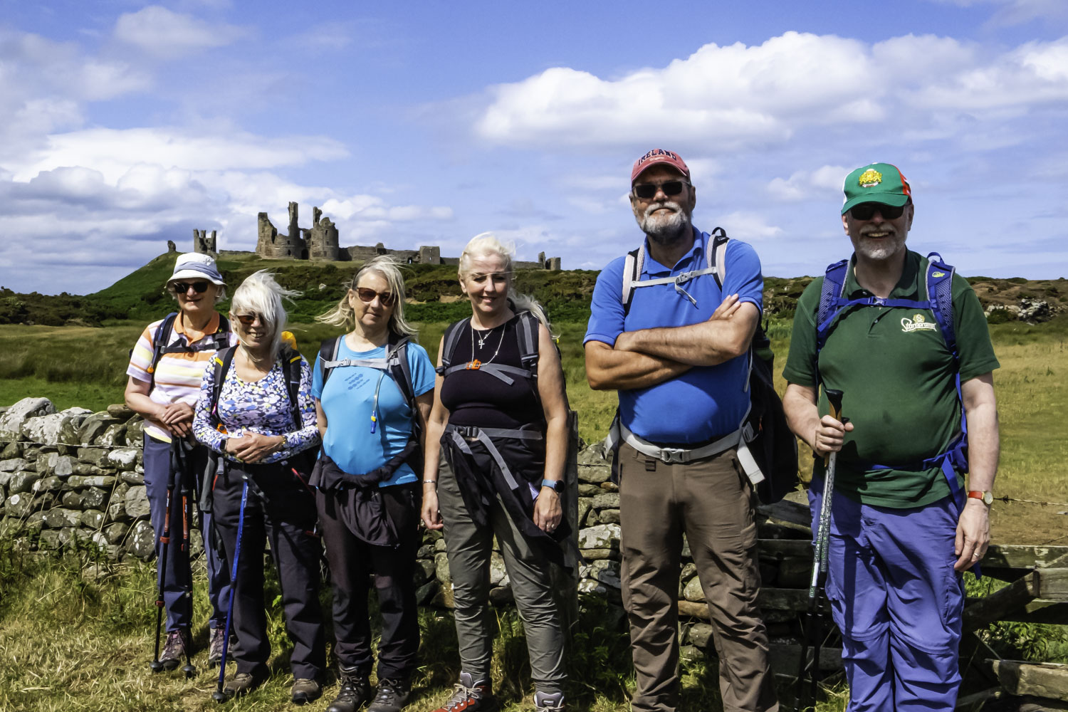
After lunch, we headed N along the grassy path leading to Dunstanburgh Castle. Reaching the gate near Nova Scotia, io climbing up the path to the castle keep, we took the lower path to the NNW which gives a different but equally good view of the castle. After passing the castle we headed past the golf course to take the path heading along the cliff top/dunes. The view ahead was excellent as we were able to see the whole of Embleton Bay illuminated by the sunlight. Looking back we had good views of Rumble Churn which in appearance is almost a mirror image of Cullernose Point. We then took a path leading down to the sands. There was a question as to whether we should continue walking through the dunes because there was only a narrow strip of firm sand as the tide was coming in quite rapidly. However, we decided to continue along the water’s edge although having to make a quick departure onto the soft sand on a couple of occasions as the tide came rushing in. We did have time to look back and see the unmistakable view of Dunstanburgh Castle. Just in time, we headed away from the sea as the tide came closer, and we made for the dunes and then the golf club house. It just remained to climb the fairly long road up to Embleton village.
Another excellent day on the Northumberland Coast in great weather.
Click on any photo to view full screen. Move through the gallery using the < > arrows.


")


To view the route, click on the adjacent file name 250626 Embleton