28 – 05 – 25 MIDDLETON-IN-TEESDALE
Distance 17.6 Km (10.9 miles) Ascent 211 m (692 ft) Average moving speed 4.18 Km/hr (2.60 mph) Start 10.39 am Finish 16.49 pm
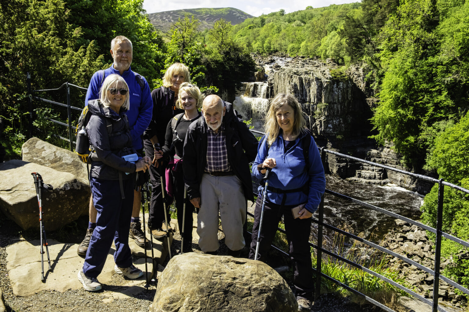
Seven of us left the coaches just SE of Langdon Beck YHA on a fairly cloudy morning but with patches of blue sky. While there was some wind, I knew it would be at our backs for the vast majority of the walk so no problem. We headed SW to Saur Hill Bridge and The Pennine Way although we did not cross the bridge, instead we turned left on a narrow footpath next to the Harwood Beck. My initial reaction was to have gone thro a gate into a field just before the path as the path was fairly concealed and walking across the fields would have been easier than this rough path. Anyhow, the path turned SE and we continued alongside the Harwood Beck which was flowing well despite the lack of rain for the previous few weeks (at least on Tyneside), although it had rained significantly the previous day. A little further and the Harwood Beck joined the R Tees, the joint river named as the R Tees. On reaching the next bridge near Wat Garth, we crossed the bridge after a group photo and headed to Cronkley. Passing thro the farm, I made a mistake in continuing SE thro the buildings insted of turning SW so after about 50 m we had to back-track to a gate. This then enabled us to climb the hill in a southerly direction to High Crag. We had seen Heinrich’s group going up the hill so I should have realised sooner. Finding a spot sheltered from the wind, we decided to have our morning break as it was becoming quite warm and it had been a climb. As we were resting and eating, Steve and his 17 troops came marching past.
On our way again, after the path turned ESE along Bracken Rigg, we had good views of the Tees some 100 m below us. As the path subsequently dropped to river level, we headed E, passing the quarry on the opposite bank, the noise of the equipment answering our earlier question as to whether the quarry was still operational. Opposite the quarry, we decided to have a closer look at Bleabeck Force, a waterfall we had seen from Bracken Rigg. While narrow there was a fair volume of water falling over the fall and the surrounding rocks and trees made for an attractive view. As the Tees turned NE, about half a KM further on we came to High Force. Although we had a late morning stop, this seemed a good place for lunch so we sat on the grass next to the top of the Force and enjoyed lunch in the warm sunshine and some of us took the opportunity to take photos of the water gushing over the top of the rocks.
After lunch we headed about 150 m ENE where we took a track off to the left and visited the viewpoint where we were able to see the whole of the Force. Rejoining the Pennine Way, we continued alongside the Tees which provided some attractive views. After some distance we arrived at the upper part of Low Force, a series of small falls. A short distance further we continued the Phoenix tradition of a couple of the group sitting on the stone sheep at the approach to Wynch Bridge. Near to the entrance to the bridge there is a good view of the lower section of Low Force. Crossing the suspension bridge we headed NE on a good track through a wood and then crossed the B6277 to Bowlees Nature Reserve. After some of the group visited the toilets, we headed up the Bow Lee Beck to view Summerhill Force and behind it Gibson’s Cave. Again this is an attractive spot. Heading back down to the B6277 we crossed the road and took a path heading SSE which brought us to the north bank of the R Tees. I had decided to use the north bank of the Tees for the remainder of the walk as I was concerned about the number of awkward stiles on the south bank. After less than 1 Km I was starting to regret this decision as there were probably more stiles on this north bank of the river and many were in poor condition. However as we continued there were only a few stiles and more gates, so it possibly was the better route. As we arrived at the big left hand bend in the river, we were walking in an open meadow covered with flowers so this was very enjoyable. At the end of the meadow we continued on a path through a wood and this brought us to the B6277. My planned route was to cross this road and climb through the fields to Stonygill Head and approach Middleton on a minor road via Lane Head to avoid traffic. However, at this point we were about 30 min behind the clock and as we were 10 min late in starting we would only have around 30 min in the pub. So after consultingg with the group we decided to walk along the B6277 in single file taking great care re any approaching vehicles. In the event, there were not a great number of vehicles and most slowed down when they saw us. After 0.8 Km we arrived at Dent Bank where I intended taking a path down to the Tees. However there was a notice saying the path along the river was closed due to erosion. So we continued on the road and when we reached Breckholm we took another path down to the river. Again we say a notice referring to erosion but we decided to continue on the basis that it was probably referring to the upstream path. Our assumption was correct as there was a reasonable path all the way to the bridge at Middleton. Heading N through the village we arrived a the Forrester’s hotel at 16.49 which left us 56 min in the pub!!
A good walk in ideal walking weather and with some excellent scenery.
Click on any photo to view full screen. Move through the gallery using the < > arrows.


")
")
")


")


To view the route, click on the adjacent file name 250528 Middleton in Teesdale
Just catching up on these great blogs.
Once again a lovely reminder of very special days