31 – 07 – 25 ELSDON
Distance 14.7 Km (9.1 miles) Ascent 303 m (994 ft) Average moving speed 4.0 Km/hr (2.48 mph) Start 10.25 am Finish 17.14 pm
Leaving the coaches beside Elsdon Parish Church on a cloudy but fairly warm day, 6 of us headed NE out of the village. After passing the community centre, we saw the Motte & Bailey castle on our left. We found the RoW which continued in a NE direction climbing up the field. The RoW did not exist for long and soon we were zig-zagging through the tufted grass until we reached a wall which bent around to the right thus heading E. After a short while, we passed through a gate and joined a minor road/track initially heading E but then bending to a S direction before passing Landshot Glebe. It was a joy to be on the road after the tufted grass. At the subsequent junction we turned left and passed Landshot, after passing the non-existant RoW and skirting to the south of the buildings. There followed a steep descent to a stream where we met Florence waiting for us. The RoW headed to a stone wall and we followed this as it curved from NNE to ENE. When I say followed this, it was a case of keeping near the wall and finding the best way forward. As the climb was getting steeper and the route more difficult, I decided to have our coffee stop here rather than the top of the wall.
After our stop, we continued climbing to where we joined another RoW heading SE below Landshot Hill. This part of the route involved fighting our way past large bushes of Fern (see photos) – not much fun. We passed a stile into the “field” to the south, but I was not happy with it so we carried on, finding another stile which we crossed and then managed to find, with difficulty due to bogs, reeds etc., the RoW I was looking for heading slightly south of east. Once again this RoW (I refrain from using the word “path”) was a mix of long grass, reeds and bogs which became even worse as we walked parallel to a stream as we headed to East Nook. At East Nook we joined a road (more of a track) but it was much better than the reeds etc. This took us down through the forest to Whitlees where we started looking for a RoW on our left, heading into the trees. Once again there was no path so we continued down the road and then turned E on a good forestry track. On reaching the point where the RoW should have emerged from the forest, again there was no sign, nor was there evidence of the RoW heading E thro Harry’s Wood. Giving up on the idea of heading ESE thro Harry’s Wood to Manside Cross, I decided to join a good track marked as a RoW and headed SE. Reaching another good track heading NE, we decided to stop at the junction for lunch.
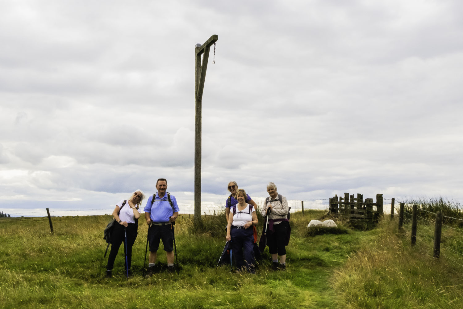
After lunch we continued along the track and met Ann’s group travelling in the opposite direction. The two groups then exchanged tales of woe about their adventures so far. I advised Ann to keep to the roads as much as possible while she warned me about Rushy Knowe. So we parted and my group continued SE. I knew we had to leave the good track to follow a RoW but couldn’t initially find it so we back-tracked and after a lot of searching found a slightly downtrodden route continuing SE. The fact that it was slightly downtrodden was probably due to Ann’s group. So we continued SE passed Bellion Edge on a narrow strip of bog, reeds and tall grass, trees to the right and remains of trees and felled branches etc. to the left. After very slow progress, we arrived at Rushy Knowe. Well if we thought we had suffered problems previously, it was nothing compared to what lay ahead. Looking at the RoW heading to our right, WSW, there was no way we would get through, so I decided to head left for a short distance and then SSE on a track. There was only one problem, while there was an obvious gap in the taller trees, small trees and bushes littered the ground. We made only 30 m progress in over 2 minutes, and as we were already well behind the clock there was no way we would make the bus using this route. So I told the group to head to the right to find the RoW as I knew Ann had used this route, albeit with difficulty. It was difficult, but at least we kept moving and once on the RoW as it curved SW, we found a reasonable surface which led to a good track heading SSE. Down this track towards Harwood Head and we were soon on the minor road heading to Elsdon. At last we could build up a head of steam and we were soon at Winter’s Gibbet where I took a group photo and relayed the Tale of Henry Winter who with two female accomplices murdered Margaret Crozier at Raw cottage, 2 mile N of Elsdon. Then it was a long trek along the road, although we did have a misty view of Cheviot in the distance to keep us company most of the way. Approaching Elsdon, at a double bend we left the road and headed down a field with a grass cutting tractor for company. With less than 0.5 mile to go we hit a final problem, not finding a way through a fence to cross a stream. Taking a route back onto the road we arrived at the pub with only 20 minutes to spare when at the start I expected to have over an hour in the pub.
What a walk, more than a mile shorter than planned and yet we lost at least 50 min. Two problematic walks in a row. I’m pleased that Florence is leading the next one.
Click on any photo to view full screen. Move through the gallery using the < > arrows.


To view the route, click on the adjacent file name 250731 Elsdon
It was another difficult walk but I love a challenge. It was still a good day & thanks for getting us back safely to the coaches in time 🥾🥾
That certainly was a memorable walk Peter.
Always enjoyable though. Thanks for leading us!