14 – 07 – 25 KETTLEWELL
Distance 14.3 Km (8.9 miles) Ascent 335 m (1100 ft) Start 10.46 am Finish 17.02 pm
On an overcast day with mist/low cloud on the hills, 3 groups left the coach at Cray after an interesting journey along the road from West Burton. The four of us in my group headed westward following Gilbert’s group along the escarpment above Cray Gill, on a reasonable and well defined grassy path. After crossing a footbridge over Crook Gill, we continued on the path roughly in a semi circle, heading generally westwards to Scar House. Most of the time we had a view down Upper Wharfdale but there was not a lot to see due to the mist/low cloud. At Scar House, both groups stopped for a coffee break.
After coffee or other refreshment, our group headed down the farm drive to Hubberholme. This was a solid concrete surface, so good for walking except for the steep slope downhill – not good for my arthritic knee. As we descended, it was obvious that the cloud and mist were starting to lift and therefore visibility was improving. The tiny village of Hubberholme, or should it be hamlet, had come into view with the church tower particularly visible. We crossed the bridge over the River Wharfe and headed east along the road (Dales Way), passing some quite attractive houses. After a short distance we noticed a sign post pointing to a footpath on the left. Although this was about 400 m before the “A Pennine Journey” footpath shown on the OS map, we followed this path as the sign and gatepost looked fairly new so we assumed that this was a change. Sure enough, the path headed for the river and then turned SE, following the river bank. At a bend in the river, we did notice the path on the map joining us on the rhs. We followed this riverside path for 1.5 Km with some attractive views of the river until we arrived at Buckden. To both add a bit more distance to the walk and also to look at some of the old interesting buildings I had planned to wander around the village and this we did, although unfortunately, a quite heavy rain shower started as we wandered. As it was after 1.30 pm, we found a couple of seats and had our lunch despite the rain.
By the time we had finished lunch, the rain had stopped and we made our way to the north of the village, into the car park and followed the wall eastwards bumping into Steve’s group on the way. We continued to follow the wall and then headed down to cross the Buckden Beck. Fortunately due to all the dry weather on previous days/weeks, there was not a lot of water in the beck and we were able to cross using the flat stones in the river. Climbing away from the beck, we joined a footpath on the east side of a wall. As we walked S, gradually climbing, we had good views looking down on the buildings in the village. Leaving the village behind, the path continued its gradual climb bringing good, if slightly misty, views behind us in a northerly direction, although it was difficult to get a good view southwards down the valley. As we climbed, the slope became steeper although we were still able to walk normally on a good path. As we approached a wall, the path curved almost 180 deg to the left, continuing to climb. Knowing that we had another ~180 deg turn to the right to join a descending path heading SSE, I told the group to keep an eye open for any path going horizontally to meet it. Unfortunately as they were ahead of me they decided there and then to cut off to the right even though there was no path. I continued ascending until I found a suitable path heading horizontally to meet the SSE path. Fortunately the group waited for me to join them and we continued SSE descending slightly on a good grassy path. By now the weather had improved significantly, the low cloud and mist had virtually disappeared and visibility was much better. The view down Upper Wharfdale was excellent as we approached the village of Starbotton. After passing through Starbotton, we took a right turn onto a track which took us to the R Wharfe. After crossing the river via a footbridge, we re-joined the Dales Way on the west bank of the Wharfe. We then stopped by the river bank to have an afternoon stop. As we were well ahead of time this became a lengthy stop as we sat stoking up the sun.
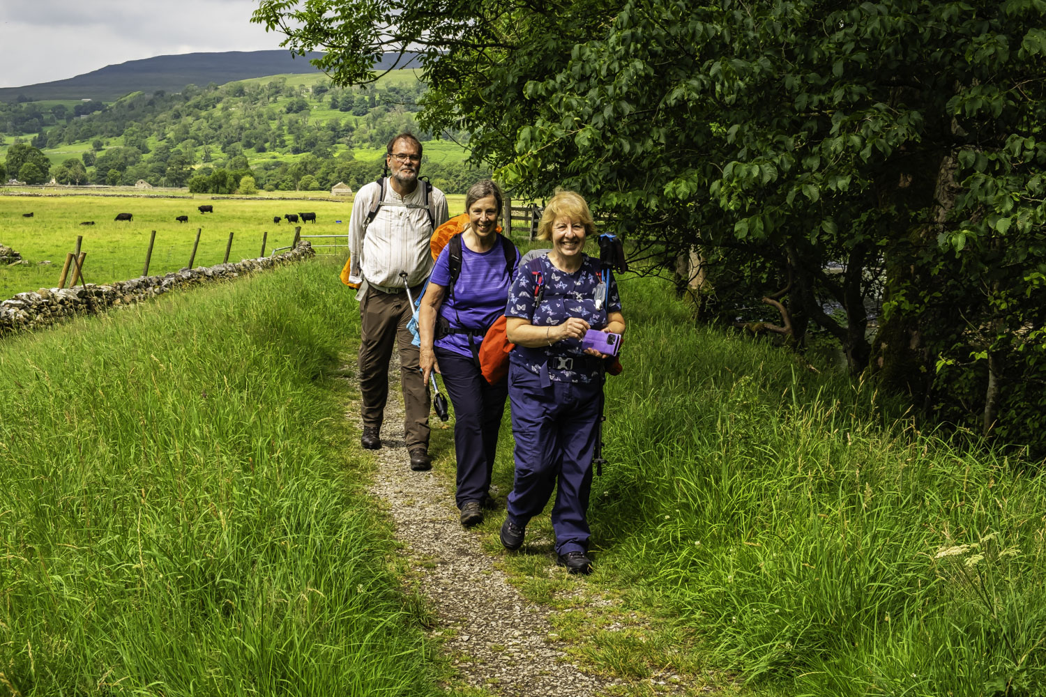
On our way again, we followed a generally good, mainly grassy track through fields, with excellent views of the river and the valley in the sunshine. We did manage to get off track near a double bend in the river due to following the river too closely but soon recovered our position (photo of the group approaching an old farm building) and continued thro the grassy fields crossing some stiles in the process. As we approached Kettlewell, the path became a track and was gravelled, ensuring that our finish was fairly easy. Following the river around a right bend followed by a left turn onto the bridge brought us into Kettlewell and next to the coaches.
After a poor start, at least in terms of visibility, the day improved and there was relatively easy walking, even up the valley side after Buckden and some excellent scenery once the cloud had cleared.
Click on any photo to view full screen. Move through the gallery using the < > arrows.


")
")


To view the route, click on the adjacent file name 250714 Kettlewell