08 – 07 – 25 BRAITHWAITE
Distance 16.3 Km (10.1 miles) Ascent 269 m (880 ft) Average moving speed 4.2 Km/hr (2.61 mph) Start 11.05 am Finish 16.53 pm
On a beautiful sunny day, six of us plus a couple of other groups left the coach on the B5289 at Great Crosswaite about 300 m NE of where I had intended, but whats 300m in over 16 Km. Making our way SE, we crossed the road bridge over the R Greta into Keswick and made our way to Isthmus Bay and then via Crow Park to Keswick landing stages. Finding seats behind the landing stages we had our morning coffee stop. From here, we had great views of Causey Pike and Grisedale Pike across the lake.
After coffee, we headed S to Friars Crag from where we had an excellent view down Derwent Water and across the lake to Cat Bells. Rejoining the RoW, we went SE then E to Stranshag Bay where we had further good views down Derwent Water. Continuing E to The Ings, we then headed S to Calfclose Bay where we saw the stones with the inscriptions standing in the water (see photo). As the stones were partly in the water, Dorothy reckoned that the water level must be quite high as they are normally on dry land. This was surprising due to the recent hot weather and lack of rain. We then headed S on the permissive path on the narrow strip between the lake and the road. At one point, we had to clamber up onto the road as a rockfall had blocked the path, so we continued on the relatively quiet road until we reached the Barrow Bay landing stage. Here we headed back to the lakeside and found a suitable spot for lunch. This was a beautiful sunny spot where we were able to watch a couple of ferries come in and with great views of Cat Bells and Skiddaw.
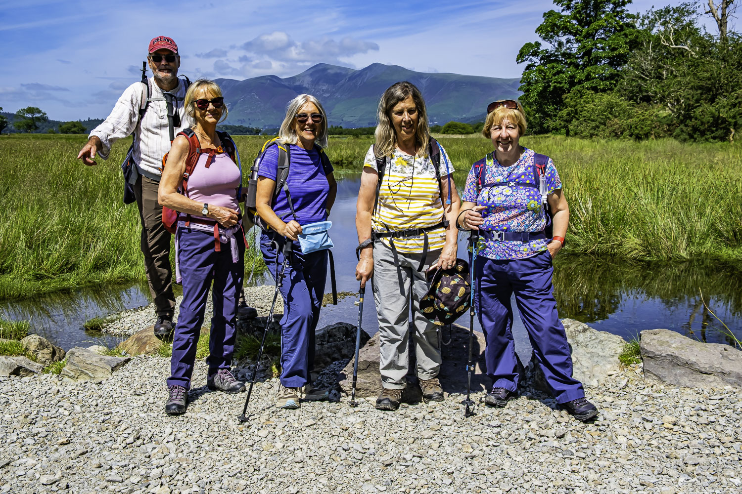
After lunch, we followed the permissive path southwards, generally alongside the lake until we came to a car park where we had to leave the lake, cross the road and follow the RoW southwards. As we approached the Lodore Hotel, we rejoined the road until we turned right (W) to cross Cannon Dub. Before crossing the River Derwent, a view up the river with Skiddaw in the background made an excellent spot for a group photo. Continuing W along a good path we headed around Park Neb before turning NW as we made for Brandelhow Point. As we approached Otterbield Bay, we had another good view of Cat Bells. Passing Hawes End Outdoor Centre we then joined a road and headed north and then west. This brought us to the Swinside Inn which seems to have been improved since I last stopped there before Covid. So we went into the paved and shaded courtyard, bought drinks – necessary in the heat and stopped for a good 40 min. The view from the inn gave us Causey Pike and Rowling End.
Leaving Swinside, we headed NNW on a minor road to Little Braithwaite. We were joined by a couple of walkers on this part of the route who then left us in Little Braithwaite as they took a FP while we continued on the road. A little further on we turned left on a footpath – at least we did when it was pointed out to me that I had already passed the path. This path climbed slightly to Braithwaite Lodge where we turned north through the farm on a footpath heading into Braithwaite. Along this path we had a great view of the outskirts of the village backed by the towering peak of Skiddaw.
A lovely circular walk around 75% of Derwent Water. The sunny weather and the brilliant scenery made for a great day (imo).
Click on any photo to view full screen. Move through the gallery using the < > arrows


To view the route, click on the adjacent file name 250708 Braithwaite
Brilliant walk. It’s lovely to be able to see the fabulous photographs of such a special day. Thanks Peter