24 – 02 – 25 WOOLER
Distance 16.6 Km (10.3 miles) Ascent 402 m (1318 ft) Average moving speed 3.32 Km/hr (2.06 mph) Start 10.12 am Finish 15.53 pm
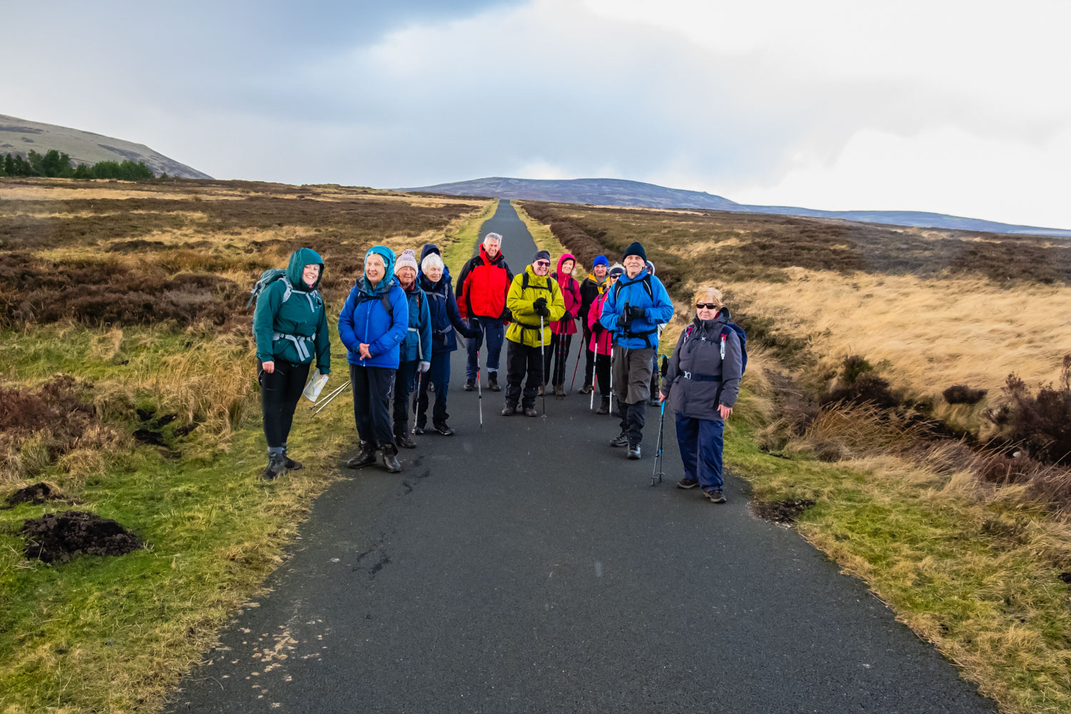
Arriving at the bus park in Wooler, 14 of us left the coach. After counting the numbers, Katherine, on her first walk & lead for the club, led the group out of the bus park and started climbing up the road heading westward towards Browns Law. A stiff climb but the group kept up a good pace and I was the only one left behind, although in my defence, I did have to stop to resolve a problem with my new rucksack. Within 25 min, a short distance before Browns Law, we arrived at the car park and picnic tables. An ideal spot for our morning stop which we enjoyed in lovely sunshine.
After the stop we were on our way again, joining St Cuthbert’s Way with a fairly steep climb through the wood and heading NNW. At the end of the wood, the track leveled out somewhat and we headed W to reach a junction of tracks. Katherine took the good track heading south (St Cuthbert’s Way) which then curved right and we began climbing up Coldberry Hill. The track then headed WNW towards Gains Law. The track was relatively flat until we approached Gains Law at which point there was a slight climb. After Gains Law the track bent to the SW and at the point of the bend we had a good view down towards the Akeld Burn valley. We had also had good views of Cheviot, Hedgehope and Yeavering Bell although the murky atmosphere spoilt it slightly. Around this point, we had our first experience of rain. Unfortunately, subsequently there were to be other short periods of rain and a couple of hail showers. Anyhow, we continued in a WSW direction before crossing to the north side of the fence line but still on a good path. Around the point where we crossed the fence line we had the sight of a full rainbow to the north. Soon after, the track split with one leg heading south to join the Commonburn Road and the other continuing WNW towards what should have been a small copse of trees but in fact there were only about half a dozen trees. The route to these trees was very wet and we had to make several slight detours to keep out of the bogs. Katherine had intended having our lunch stop a little further on, beside another copse near Scaldhill, but because it had stopped raining, she proposed this as the lunch stop so we sat near the headwaters of the Akeld Burn and had another sunny and lengthy stop as we were ahead of time.
After lunch, we headed SW, skirted around a non-existing copse and then turned south towards Commonburn House. Giving the farm a miss, we joined the newly tarmaced road leading E to Wooler. With an excellent surface under our feet, we made a good pace. After about 1.5 Km, Katherine was looking for a path heading off to the right (S then SE) towards the wooded banks of the Common Burn. Having found the path, it was in reasonable condition at first but it soon became an exercise in keeping out of the large pools of water covering the full width. We progressed along the path slowly and then it turned ENE and it became significantly dryer. As we continued ENE we had good views of the Cary Burn Valley. Soon we were joined by the Hell Path climbing up from the burn. On a very good track now, we progressed to Wooler Common Farm. Skirting around the farm, we continued NE on St Cuthbert’s Way, climbing up Kenterdale Hill thro the woods. At the top we waited for the rest of the group to catch up and then made our way down to Waud House. This was an awkward descent on a muddy slippery path and it did not go well with my arthritic knee. Reaching Waud House, we then rejoined the pavement on the road we had climbed from Wooler and made our way back down to the town, the coaches and the pub.
A very enjoyable walk, despite the occasional rain and hail showers, in one of my favourite areas of Northumberland. Thank you Katherine – well led.
Click on any photo to view full screen. Move through the gallery using the < > arrows.


To view the route, click on the adjacent file name 250224 Wooler
A great write up Peter and really lovely pictures! Thank you!