18 – 12 – 25 RICHMOND
Distance 13.7 Km (8.5 miles) Ascent 319 m (1050 ft) Average moving speed 4.18 Km/hr (2.6 mph) Start 10.20 am Finish 15.35 pm
We left the baths on a grey morning and headed for the A1M. After a while the bus slowed as we came to a queue of slow moving traffic. This continued for some time and then we noticed a fire next to the road in front of us. Reaching the spot, we discovered it was a van completely ablaze with flames spurting from it. Once past, we continued on dropping people off the coaches starting at Scotch Corner and through to the quarry lay-by just before Downholme Bridge where we were the last group to get off.
After leaving the coach we continued down the A6108 for a short distance to the bridge. Florence led us across the R Swale and within a few yards left the road, over a stile and down onto a grassy field. Having walked this way several times I was rather concerned that the fields could be very boggy based on the flow of water we had seen as we crossed the bridge. I am pleased to say that the fields were OK, so we continued NW, initially near to the river and then towards the road to Marske. After joining the road, we continued on to the hamlet of Marske where we turned into the church grounds and had our morning coffee stop.
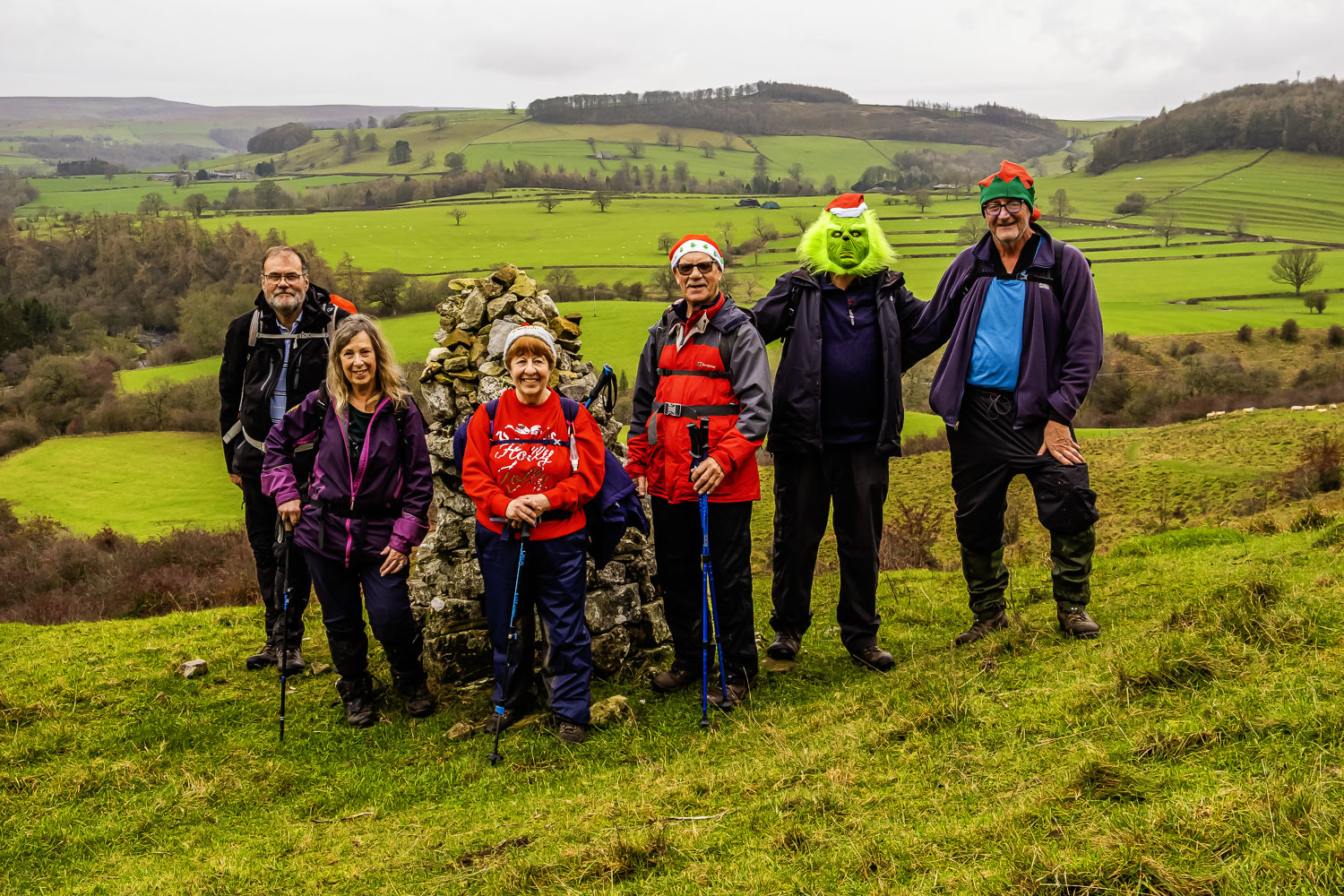
On our way again, we followed the road NE before taking a RoW off to our right. Initially quite flat, the grassy fields were again OK apart from one point where a newly formed stream ran across the grass. There was then a short steep descent to a footbridge crossing the Clapgate Beck. Taking care, we crossed the slippery bridge and then started to climb the muddy bank. While most of the group continued on the steep muddy path, a couple of us tried a less steep grassy path, however, what appeared to be a gate was tied up so we had to walk by the side of a fence to join the path the others had taken, albeit at a higher level. We then continued up the RoW towards the cairn below Applegarth Scar although some took a longer, less steep route. At the cairn, we stopped for a group photo, with Michael wearing his Gringe mask, at what should have been an excellent viewpoint but the heavily overcast sky spoilt that. At least it wasn’t raining – yet!! After the photo, we continued ESE under Applegarth Scar on a wide gravel track. Reaching West Applegarth, we continued on a grassy track towards East Applegarth, turning SW on a road to navigate around to the west of Low Applegarth. At this point we were descending to the river in a SE direction which then turned E as we reached the R Swale. Just before a bend in the river, Florence found the remains of a wall with some fairly flat stones on which we were able to place a tablecloth, our shared food and, of course, a couple of bottles as it was the Christmas walk.
After eating & drinking and a bit natter, just as we were packing up, the anticipated rain started. So with waterproofs on, we continued on the grassy path SE under Whitecliffe Wood. There was plenty of shooting as we passed the wood, so we hoped they were looking for pheasant for Christmas lunch rather than a human lunch. We continued SE on the flat grassy area rather than climb into the wood until we reached the point where the wood came down to the river. We then joined a rough and muddy path into the wood before emerging at Lownethwaite Farm. After passing the farm, we joined a tarmac track which brought us down to the A6108. Crossing the road brought us to a footpath, which then brough us to a footbridge leading to Round Howe. Passing below the hill we took the longer route beside the river before turning S and entering Billy Bank Wood. Initially we walked near the river mainly on stones but where the river turns E, Florence decided to climb the steps to a higher path. This was a wise move, as my experience was that further east, the lower path would be under water due to the high river level. We continued along this path involved several sets of steps until we reached Richmond Bridge. This was decision point for Florence – did she cross the road to add a bit of a loop or go straight into Richmond as the rain was quite heavy at this point. Everyone seemed happy for the longer walk so we headed to the footpath next to the football pitch and continued our way along the south bank of the R Swale. As we headed E, we passed the south wall of Richmond Castle towering above us on the opposite side of the river. Little possibility of an attack from that flank! After the bend in the river, we headed E to the A6136 and then headed NNW past the old railway station and across the Mercury Bridge. On the north side of the bridge, we turned onto a tarmac path leading to the north bank of the river. Making our way SW along the river, we soon came into sight of the waterfalls although they are probably better described as rapids. The volume and speed of the water passing over the falls made for an impressive sight although it would have been much better had there been more light. It was after all 15.20 pm, 3 days before the shortest day on a dark/wet afternoon. Leaving the river, we made our way up to the market place and then up to the bus park.
Despite the poor weather, this was a good & interesting walk. Thanks for leading Florence.
Click on any photo to view full screen. Move through the gallery using the < > arrows.
")


")
To view the route, click on the adjacent file name 251218 Richmond