17 – 4 – 25 EYEMOUTH
Distance 17.4 Km (10.8 miles) Ascent 476 m (1560 ft) Average moving speed 4.35 Km/hr (2.7 mph) Start 10.05 am Finish 16.18 pm
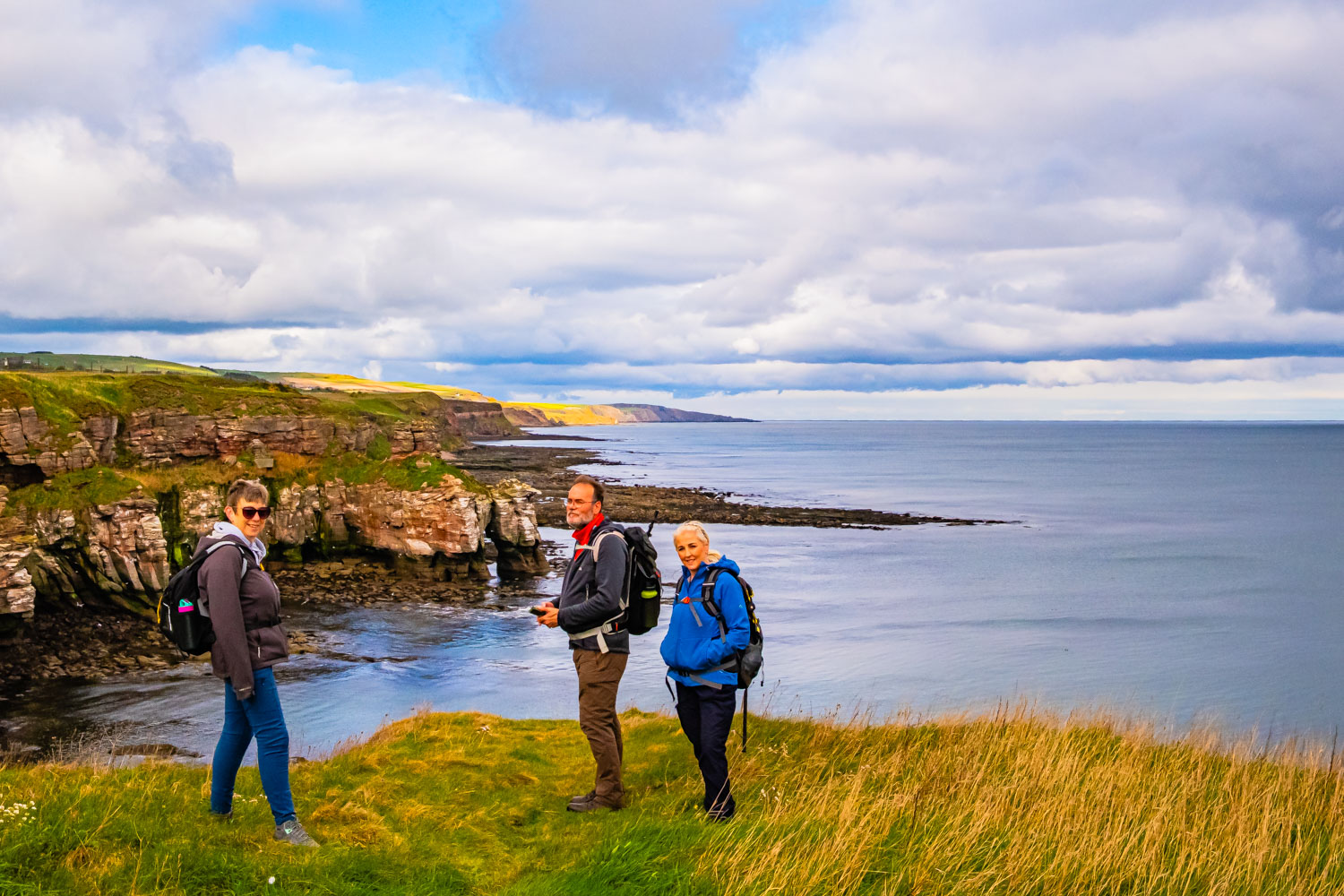
Leaving the coaches at the north end of Berwick adjacent to the cemetery, four of us headed ESE and then NE on a footpath adjacent to the golf course. Reaching the cliff tops, we descended down a steep slope and turned N then NW along the top of the cliffs. It has to be said, for an important RoW (King Charles III Coastal Path / Berwickshire Coastal Path), the path is in poor condition being very uneven and in places sloping close to the cliff edge. Anyhow, we continued northwards with some excellent views from the cliff tops to the sea below us. Weatherwise it was a mixture of sun and cloud, but at least at this stage it was dry. As we approached the Marshall Meadows caravan park, we decided it would be a good spot for our morning coffee stop so we headed into the park and found a suitable embankment facing the sun and protected from the wind.
After an enjoyable stop we were on our way again past the caravans and, after a short distance, we reached the Scottish border. After we passed through the gate separating the two countries I noticed that the path on this side of the border was significantly better than that on the English side. After the border, the path ran adjacent to the east coast main railway line. Near Lamberton Steers we caught sight of the small ruined bothy way below the cliff top. The story is that this was used by smugglers – smuggling being very prevelent in this part of Scotland including our destination of Eyemouth. We left the path to have a closer look but soon determined that it was going to be a very difficult descent and realised that near our first sighting about 400 m further south was the probable access route. Continuing NNW, near Catcairn Bush, we spotted a grassy bank overlooking the cliff top and with a level rocky surface below us near sea level – a suitable spot for lunch. While eating lunch, one of the group spotted a young deer on the flat rock way below us and near the edge of the sea, it seemed an unusual spot for a deer. I was also told that there was a peregrine falcon flying around, but, as I said at the time, the only birds I recognise are blackbirds, robins and seagulls.
After this entertainment, we continued NW and then at Cowdrait, where the coastal path started descending towards the sea, we turned left and climbed up to join the A1 road. This was to avoid the descent into and, more importantly, the climb out of Burnmouth. I had already planned more than 1300 ft of ascent and the group would not have appreciated a greater climb. And so we headed NNW and then joined a minor road which passed through upper Burnmouth where we then rejoined the Coastal Path at Burnmouth Hill. A short distance along the path there was an excellent view of Burnmouth and its harbour way below us. Unfortunately, the camera battery ran out and I was unable to open the battery compartment to change batteries so annoyingly, no more photos on this walk. Up to this point, it had been mainly dry with only a couple of very short showers but we noticed a very dark cloud approaching and soon after we had a few minutes of hail. However we carried on, enjoying the views of the various rock formations within the cliffs on our right – annoying about the camera. A bit of a climb brought us to the top of Blakie Heugh at 103m although it did seem we had climbed more than that. From the Heugh, we had our first view of parts of Eyemouth and whether it was that, or the downhill, our pace increased. After passing the golf club, the Coastal Path turns inland and we followed it, crossed a good road with no traffic on it and headed down to the east bank of Eyemouth harbour. For this bit of the walk we were joined by a retired local volunteering to clean up the area. Carol who had worked for some years in Eyemouth had a good chat with him. Heading back up-stream, we crossed the footbridge and made our way through the town to where the coaches were parked.
An interesting walk with good scenery, mixed weather and as usual good company although there were only the four of us.
Click on any photo to view full screen. Move through the gallery using the < > arrows.
")
")


To view the route, click on the adjacent file name 250417 Eyemouth